Best Freshwater Fishing Spots Near Me — How to Find Hidden Gems
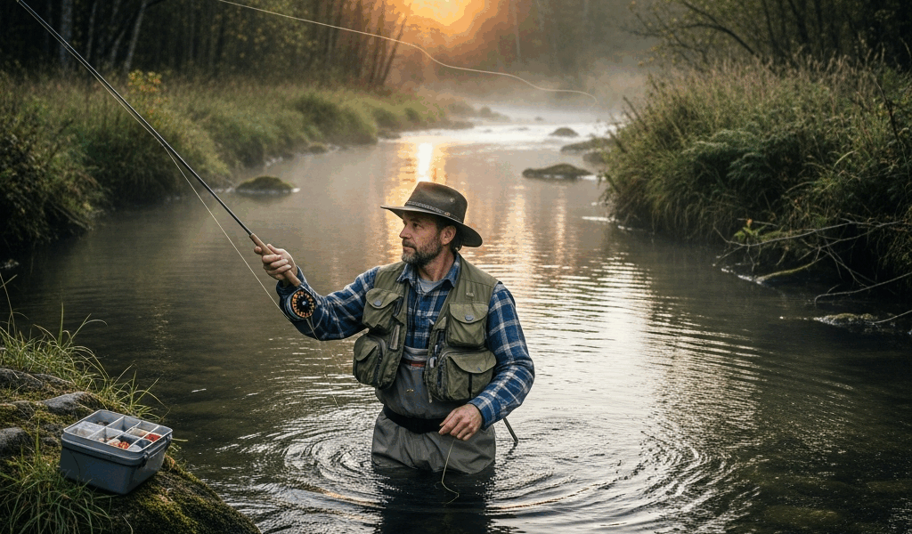
Freshwater fishing has gotten complicated with all the bad advice flying around. As someone who spent three years burning gas on dead-end scouting trips, I learned everything there is to know about finding spots other anglers actually keep to themselves. Bad trips, wrong turns, and one genuinely embarrassing afternoon I spent casting into a retention pond behind a Holiday Inn on Route 9 — that last one still stings. Nobody hands you the real process. You either stumble into it or you don’t. This is the guide I needed when I was driving around with a Shakespeare rod bungee-corded to the bed of my truck and absolutely zero plan.
The spots worth fishing are almost never the ones Google surfaces first. The community lake with the paved parking lot and the laminated DNR sign bolted to a 4×4 post? Everybody’s already been there twice this week. I’m talking about the oxbow pond three miles off the county road, the creek arm that doesn’t show up on any public land map, the farm pond where a guy named Gerald said yes because you actually knocked and asked. Those spots exist everywhere. You just need a process.
Use Google Earth Before You Leave Home
Frustrated by wasting entire Saturday mornings on water that turned out to be posted or picked clean, I started treating Google Earth like a serious research tool instead of something to kill time with. That shift — honestly, a pretty small one — changed everything about how I scout.
Open Google Earth Pro. It’s free, desktop version, no subscription. Zoom into any rural or semi-rural stretch within 40 miles of your house and stop looking for the obvious reservoirs everybody already knows about. You’re scanning for unnamed water. Small ponds tucked behind hedgerows. Creek bends that slow into pools. Drainage channels feeding into larger water. These are the places that go weeks without seeing a hook.
Water Color as a Starting Clue
But what is water color telling you in satellite view? In essence, it’s a rough depth map. But it’s much more than that. Darker water — almost black at the center — usually signals a deep hole. Fish stack there when summer heat gets brutal and again when cold snaps push temperatures down fast. Lighter green or teal closer to the edges means shallower water with vegetation — exactly the structure largemouth and panfish want. You’re reading the pond before you’ve driven a single mile toward it.
What Structure Looks Like From Above
Look for points — land that juts into the water at an angle. Look for inside bends on creeks where sediment piles up and current dies. Look for any inflow, even a tiny one. That dark line where a drainage ditch meets a pond? That’s oxygen and food moving in. Fish know it better than you do. That’s what makes structure-reading so endearing to us anglers — the fish tell you where they are if you know what question to ask.
Don’t make my mistake of ignoring access entirely. Found a gorgeous oxbow lake — maybe four acres, clearly holding fish based on color and depth — and spent 45 minutes figuring out it was surrounded on all sides by private farmland with no road touching it anywhere. Always cross-reference your satellite finds with a public land layer. OnX Hunt has one. Avenza Maps works too, with state-specific overlays running a few dollars each.
State Stocking Reports — Free Intel
Probably should have opened with this section, honestly. Because this is the fastest shortcut most freshwater anglers completely walk past without noticing.
Every state wildlife agency publishes stocking schedules. Some update weekly. Pennsylvania’s Fish and Boat Commission posts theirs at fishandboat.com, broken down by county and specific water body. Ohio runs the same thing through ODNR. Most states have a nearly identical system — search “[your state] fish stocking report” and you’ll find it in about two minutes on a slow connection.
Why Recently Stocked Water Matters
Fish fresh out of a hatchery truck are aggressive — they’re disoriented, they’re hungry, and they haven’t been educated yet by a hundred anglers throwing the same jig at them. A stocked trout on day three post-release is a completely different creature than that same fish six weeks later. Showing up to a creek within the first week of a stocking event is as close to a guaranteed outing as freshwater fishing gets. I’ve had mornings on stocked water that felt almost unfair.
Reading Between the Lines on Stocking Data
The listed locations aren’t always precise. A report might say “Mill Creek — Route 45 access” when that stretch runs nearly two miles. Look at the listed access point, then scout upstream and downstream on satellite view. Fish move to structure — the deep pool 200 yards upstream from a stocking site often holds more fish than the actual drop point does by day four or five.
Some states also publish warmwater stocking data — bass fingerlings, walleye, the occasional muskie plant. Less time-sensitive than trout stocking, but it tells you which public ponds the agency is actively managing. Managed water gets maintained. Maintained water holds fishable populations. Follow the management money.
FishBrain and OnX Hunt — Digital Scouting Apps
These two apps do genuinely different things. I use both, usually within the same scouting session, usually from my kitchen table the night before I actually go anywhere.
FishBrain runs on community catch data — other anglers logging fish, tagging locations, noting what bait worked and what conditions looked like. The free version gives you access to a solid chunk of this. Premium runs about $49.99 per year — I caught a sale and paid $29.99 — and unlocks full catch data including depth maps on select waters and catch heatmaps. The heatmaps are worth it alone. Red zones mean consistent action. Filter by species and season and suddenly you’re not guessing anymore.
What FishBrain Does Well
Finding public access points you didn’t know existed — that’s where FishBrain quietly earns its keep. The app layers boat ramps, fishing piers, and legal shoreline access areas right over the map. I’ve found three legitimate spots within 20 miles of my house through FishBrain that I’d driven past repeatedly without realizing there was a gravel pull-off and legal access. One of them, a small county-managed pond off an unmarked road outside of town, has produced more 14-inch largemouth in a single afternoon than my usual reservoir does across a full weekend. Apparently it’s been there for years. I just never looked.
What OnX Hunt Adds
OnX is built for deer hunters — but it might be the best option for general outdoor scouting, as the tool requires accurate property boundary data. That is because the core feature, the property layer, shows you exactly where public land ends and private begins, right on your phone screen, often with the landowner’s name attached. That means you can knock on the correct door and ask about pond access instead of guessing. I’ve had about a 60-percent yes rate doing this. Be polite, offer to pack your trash out, don’t be weird or evasive about what you’re asking. Most landowners just want to know someone accountable is back there.
Read the Water — What to Look for When You Arrive
All the digital scouting is just prep work. When you actually get to the water, you need to read it fast and adjust on the fly. This is the part that took me the longest — probably three full seasons — and the part no app can fully teach you.
Current Breaks
Any place where fast water meets slow water holds fish. The seam between a main current and a back eddy sitting behind a boulder or a downed sycamore — that’s a feeding lane. Baitfish get pushed into those transitional zones and can’t fight out of them easily. Predators wait there and barely have to move. Cast to the edge of the seam, not into the dead water behind it. The transition is where everything happens.
Submerged Structure
Look for anything interrupting the bottom — drowned timber, rock piles, old fence lines that run right into the water at property corners. In clear or slow water you can sometimes spot this visually if the light is right. In stained water, you’re reading surface clues instead — subtle current changes, the way ripples stack up differently over a hard bottom versus soft mud. A fish finder like the Garmin Striker 4, around $99 at most outdoor retailers, removes most of the guesswork and shows you bottom composition directly. Worth every dollar if you’re fishing unfamiliar water regularly.
Shade Lines and Inflows
In summer, shade is sanctuary. The hard edge where a treeline drops shadow onto open water is a thermal break — bass and panfish sit just inside that shadow line and ambush anything crossing into the light. Cast parallel to the shade edge rather than directly into shaded water. You want the lure moving through that transition zone, not landing in the middle of it.
Inflows matter year-round. Any trickle of fresh water entering a pond brings cooler, oxygenated water — and in July and August that spot is always worth a few casts, even if it’s just a culvert pipe draining a cornfield or a spring seep barely visible along the bank. Follow the fresh water in and you’ll almost always find fish staged somewhere nearby, usually tighter to the source than you’d expect.
The best spot you’ll ever fish is probably one you find yourself — no sticker on it, no parking lot, nobody else’s boot prints in the mud from this morning. That’s the actual point of all this. The tools just cut down how long it takes to get there.

Stay in the loop
Get the latest freshwater fishing spots updates delivered to your inbox.